


A Walk in my Neighborhood
Ancient churches, standing stones, Mount Brandon and the Cloghane Estuary

Sometimes our friends in Austria and the United States wonder why my husband, Gerhard, and I decided to retire to the southwest corner of Ireland. I think the pictures we took on a recent walk in our neighborhood demonstrate our answer more clearly than any words I could write. (I will, nevertheless, write a few words anyway!)
Mt. Brandon and Saint Brendan
Our location on the northern side of the Dingle Peninsula in County Kerry is dominated by Mount Brandon (953 meters/3,123 ft), which is located in the Brandon Group range of mountains. Formed around 200 million years ago, it is 170 million years older than the Himalayas!*
One of the things I love about Ireland is that history, legends and stories are still present wherever you go—especially if you understand the underlying meanings of the Irish placenames for villages, roads, farmers’ fields, rivers, lakes, mountains and more.
For example, Mt. Brandon was named after St. Brendan the Navigator, one of Ireland’s most beloved Celtic saints. Born in Tralee, County Kerry in 484 CE, St. Brendan is famous for founding numerous monasteries along the west coast of Ireland as well as for a seven-year-long voyage that he took in a curragh, a traditional Irish boat framed in wood and covered with sewn ox hides.
Before his voyage, St. Brendan is said to have spent three days fasting on Mt. Brandon, where he was visited by an angel and experienced a vision of a great land to the west. (This has led to the legend that St. Brendan visited the North American continent long before Columbus arrived there in 1492.)
The overall goal of the voyage was to find the Isle of the Blessed, a mythical paradise believed to exist somewhere in the Atlantic Ocean. According to The Voyage of Saint Brendan the Navigator, an ancient manuscript written in the 9th century, St. Brendan and his companion monks had numerous adventures and encounters with fantastical creatures, including sea monsters, giant birds, and even an island that turned out to be a giant sea creature. Along the way, they faced various challenges and tribulations but also experienced moments of divine intervention and miracles.
The voyagers eventually returned to Ireland, where they shared their tales of adventure and spiritual enlightenment. The story of Saint Brendan's voyage became immensely popular in medieval Europe and inspired countless works of art, literature and exploration. It also turned Mt. Brandon into a major destination for Christian pilgrims, which continues today.
O! tell me, father, for I loved you well,
if still you have words for me,
of things strange in the remembering
in the long and lonely sea,
of islands by deep spells beguiled
where dwell the Elven-kind:
in seven long years the road to Heaven
or the Living Land did you find?
—J.R.R. Tolkien
Interestingly, however, Mt. Brandon was already a center of ritual and pilgrimage before the advent of Christianity. In particular, major rituals and pilgrimages took place there at Lughnasa, the Celtic harvest festival that traditionally occurs on August 1.
High places have been chosen as religious sites throughout the world since the earliest times, and Lughnasa, which was perhaps the most important Celtic festival, was generally celebrated at hilltop sites.
The central symbol of the festival was the temporary victory of Lug, a bright, young god of many talents, over the older, darker god, Crom Dubh.
Other aspects of the rites included the sacrifice of a bull and the eating of it, a mythical dance drama, the cutting of the first corn and its presentation to Lug, and general feasting.*
In Ireland, the last Sunday of July became known as Domhnach Crom Dubh, or Crom Dubh Sunday. The festival was later adapted by the early Christians and became associated with St. Brendan.
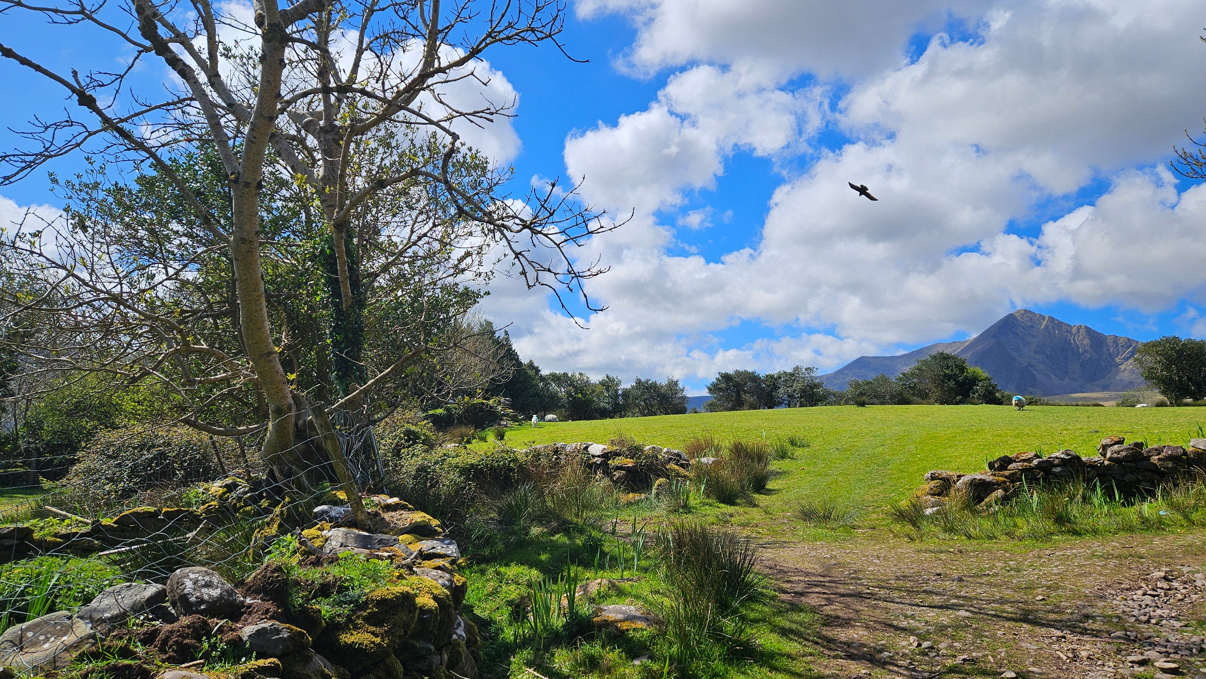
Our walk
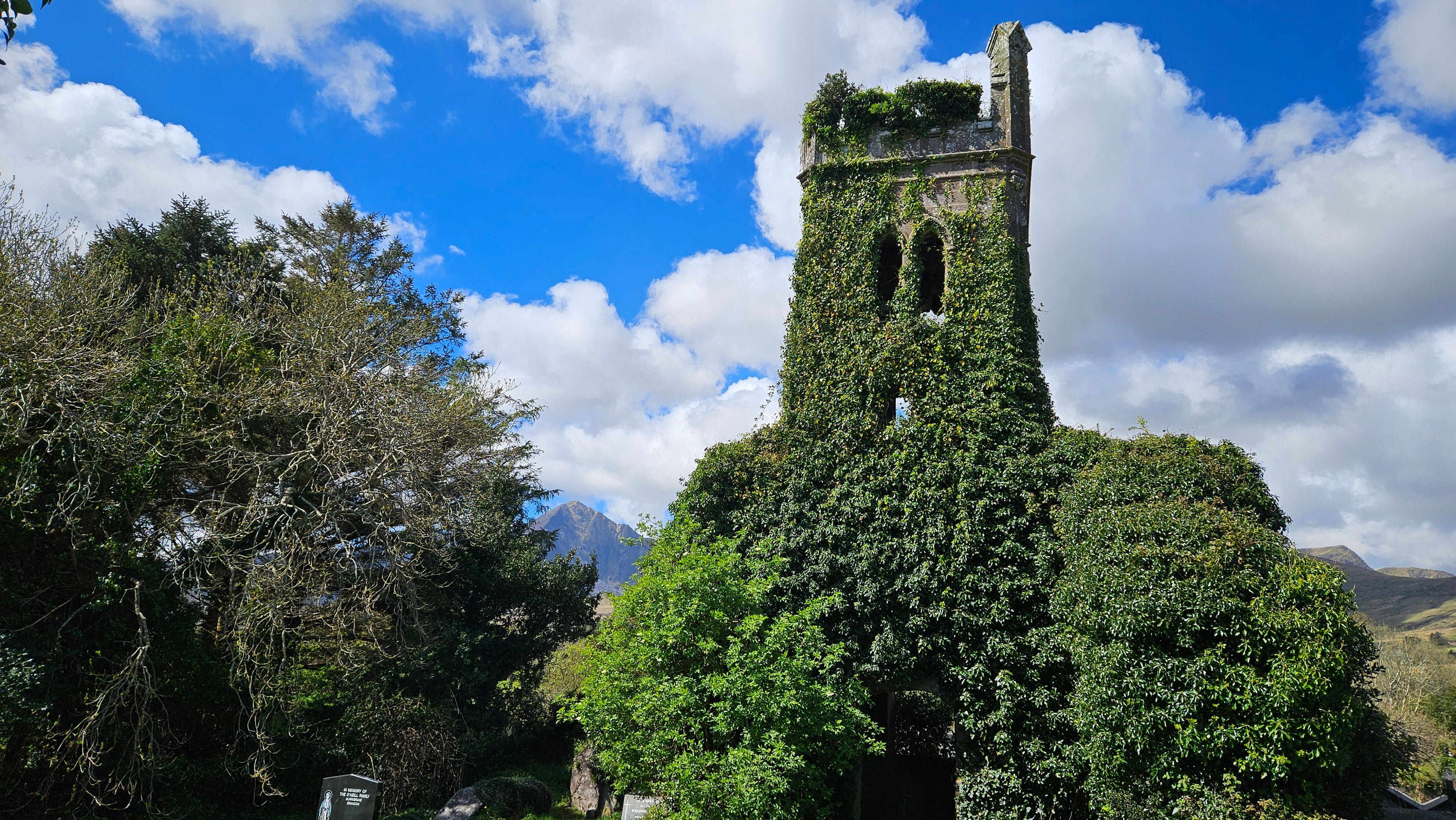
Our walk in the shadow of Mt. Brandon began in Cloghane, a small (population 297) village that is about two miles down the road from our house. A marked circular route begins in the center of town and leads almost immediately to an ancient churchyard that contains two ivy-covered ruins.
The first, Teampall Bréanainn (St. Brendan’s Oratory), dates from the 13th century. In an interesting cultural mingling, the head of Crom Dubh was originally embedded in the church’s wall. Unfortunately, it was stolen in 1993.
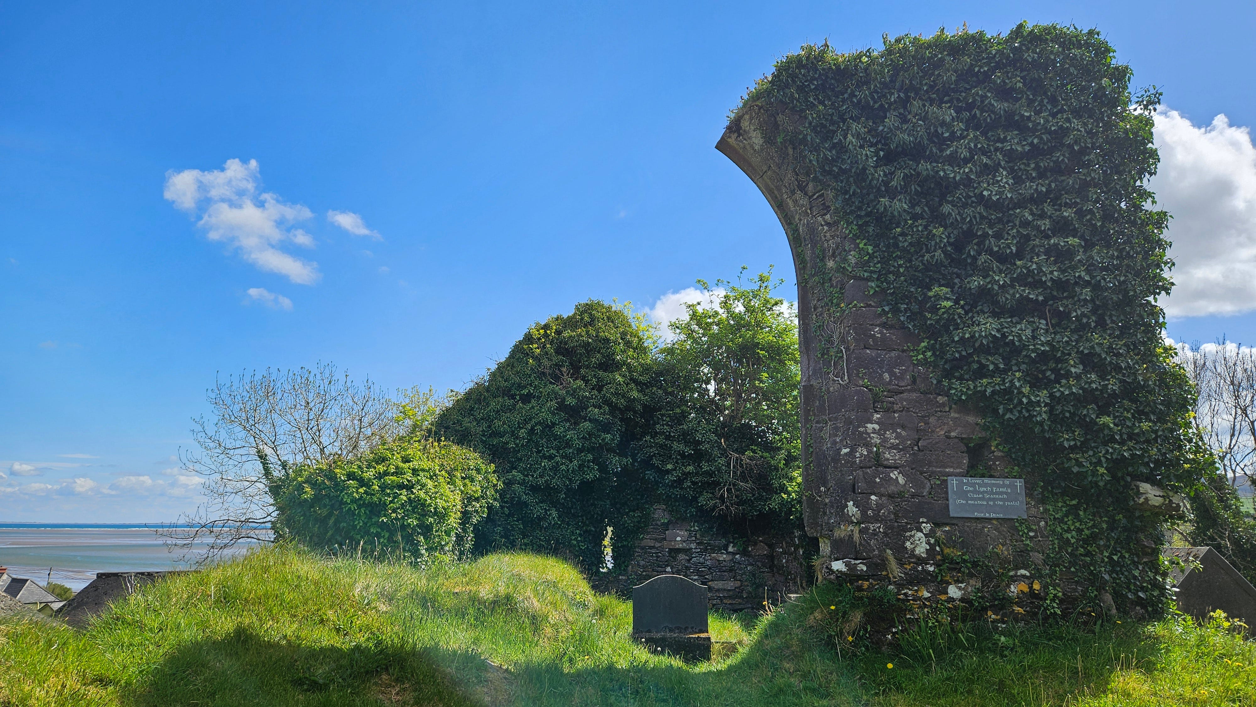
The second ruin consists of the remains of a Protestant church that dates from 1828.
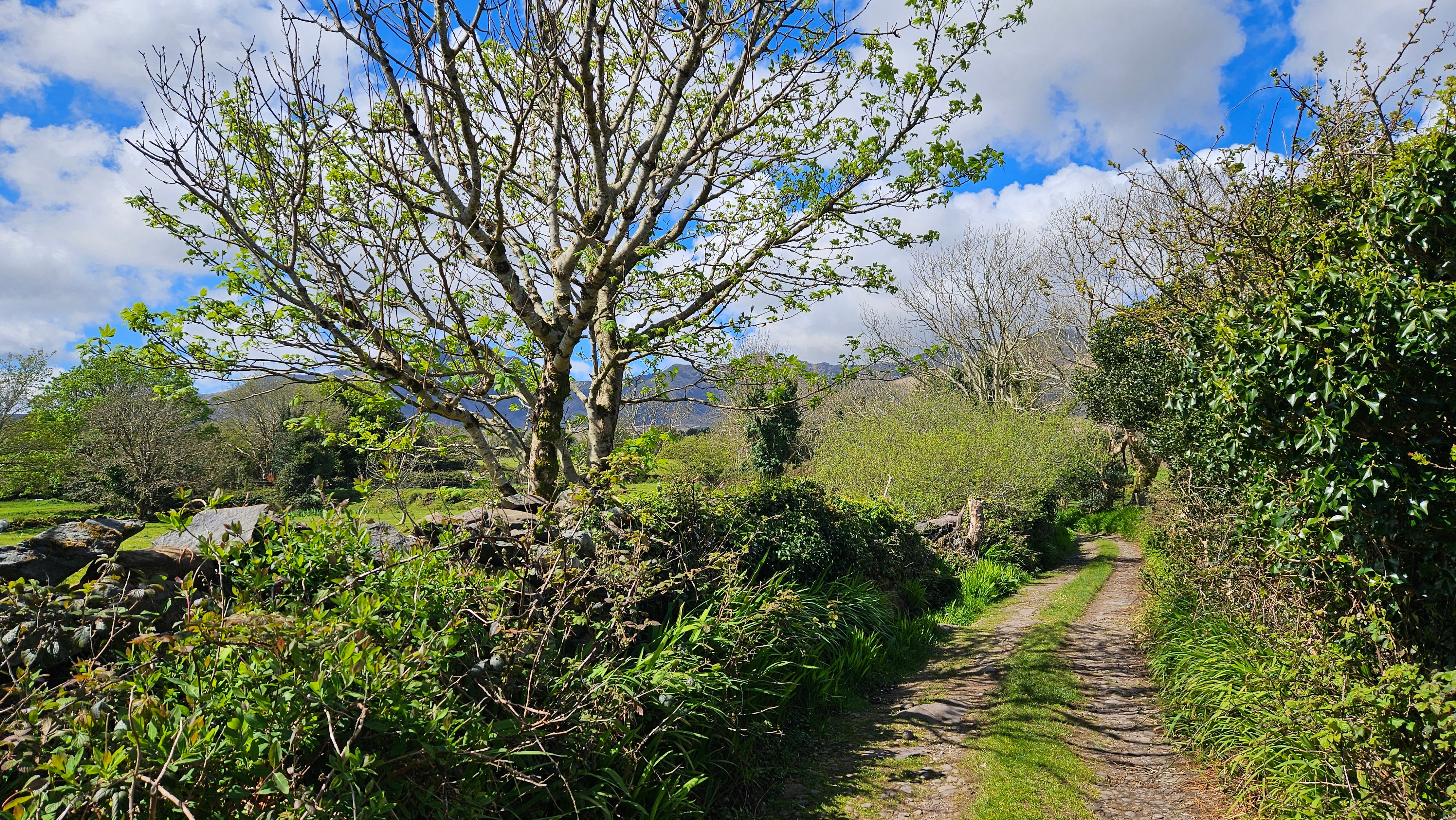
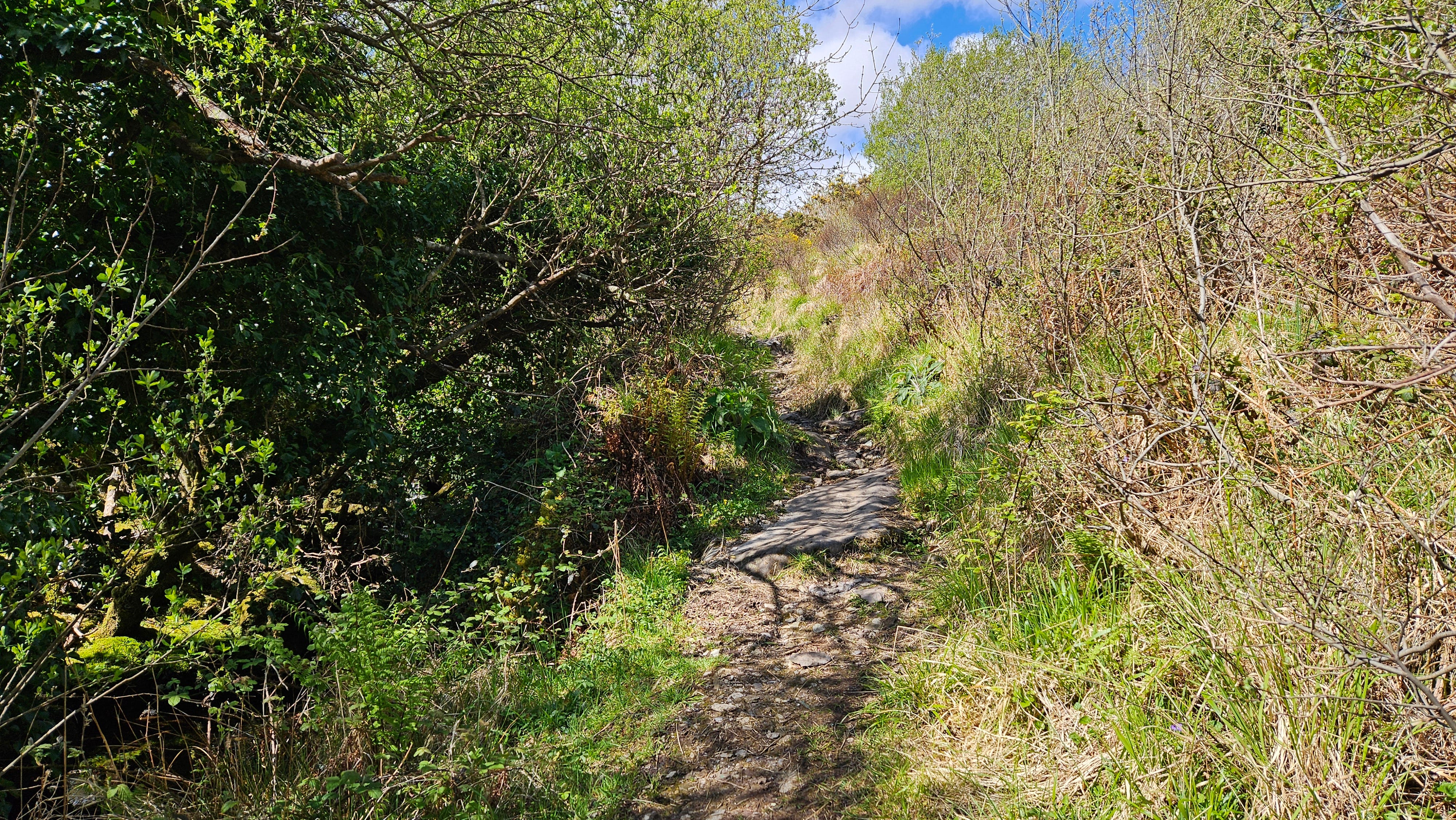
From the churchyard, we followed the signs for the Fairy Glade Walk (Siúlóid na Sióg), which took us to a dirt road between farmers’ fields.
A sign at the beginning of the walk notes that St. Brendan’s Well (Tobar Bréanainn) is located to the north of the churchyard. It also explains that the holy well was once the location of rituals accompanying the Cloghane Pattern, a great gathering held on Domhnach Crom Dubh the last Sunday in July during the ancient Mount Brandon Lughnasa Festival.
Unfortunately, the well is in a field and not easily accessible to passersby.
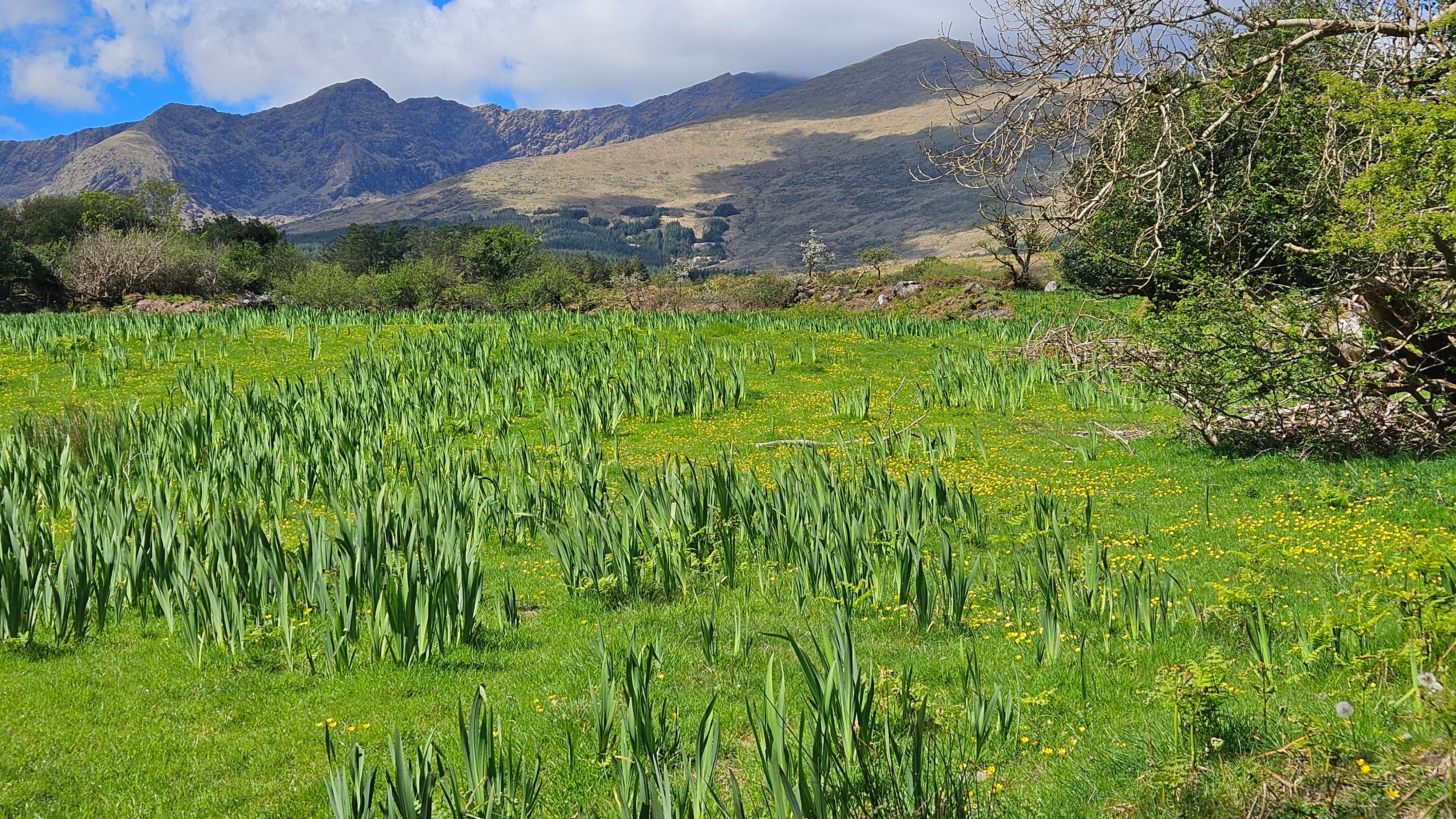
Many of the fields in this area are covered with wild yellow flag irises. By mid-May, the fields will be a mass of beautiful yellow spikes.
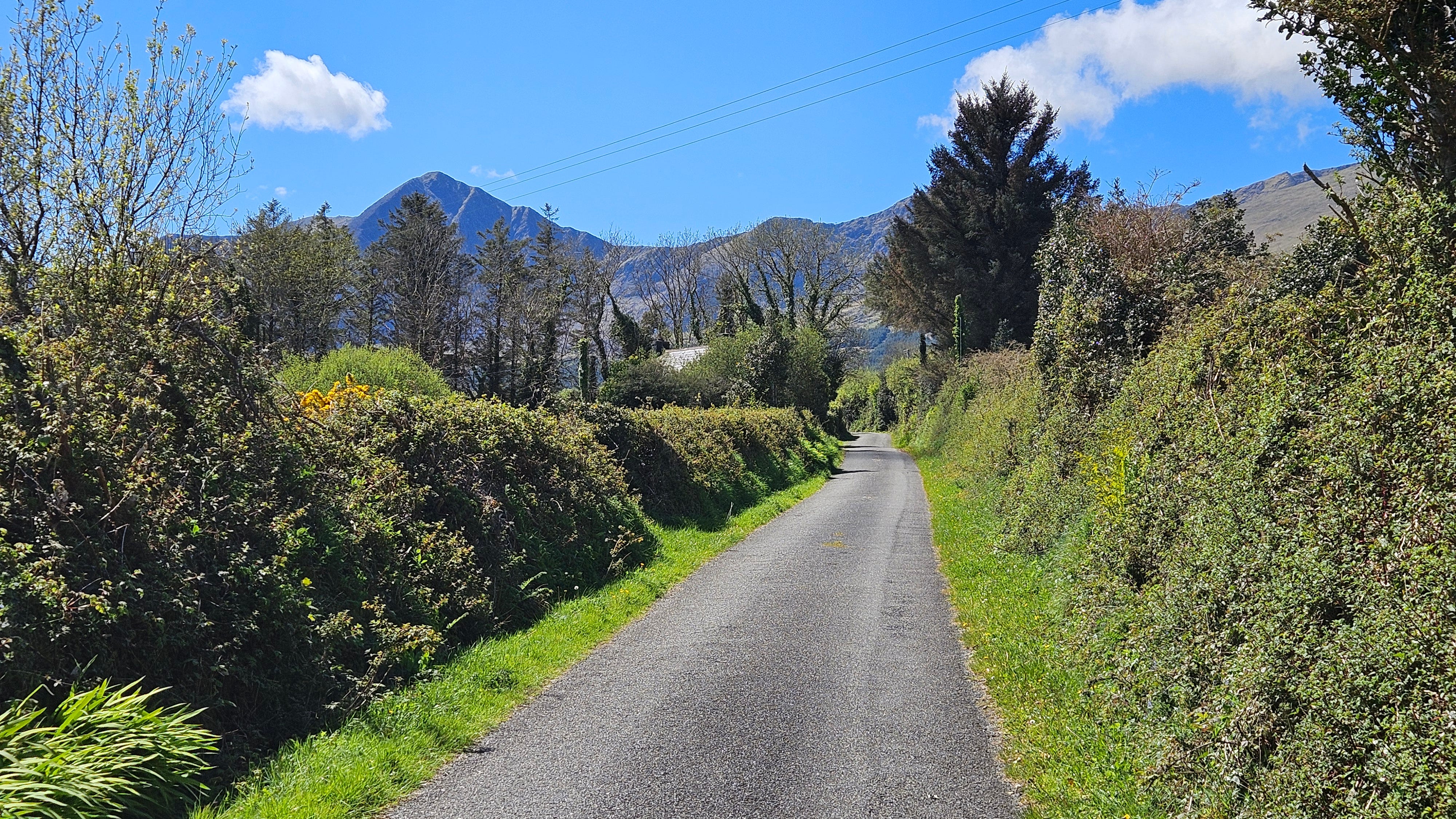
The road continually heads up the hillside and soon narrows into a dirt path.
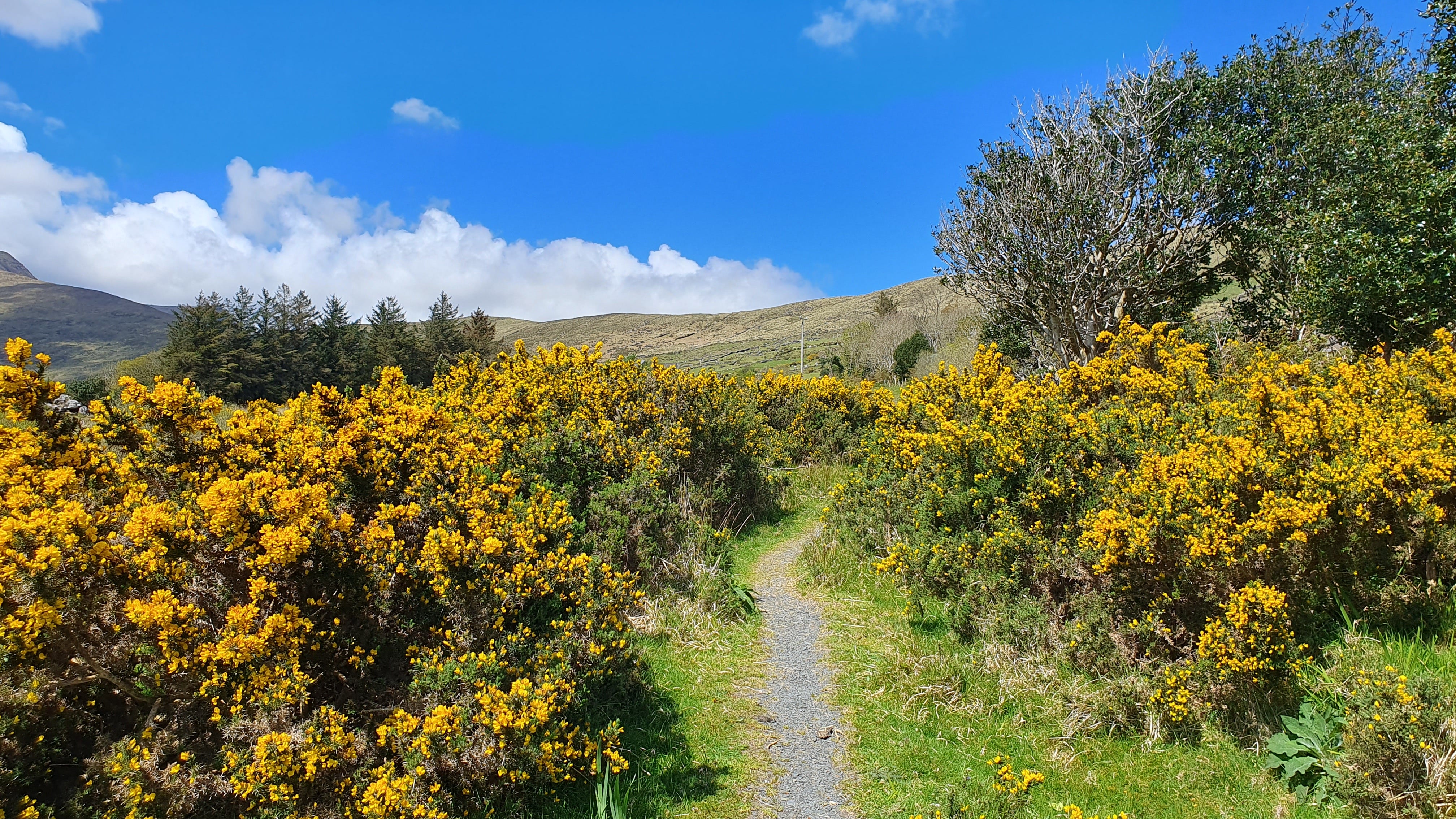
While we were hiking, we saw beautiful little violets, wood sorrel and wild primroses.

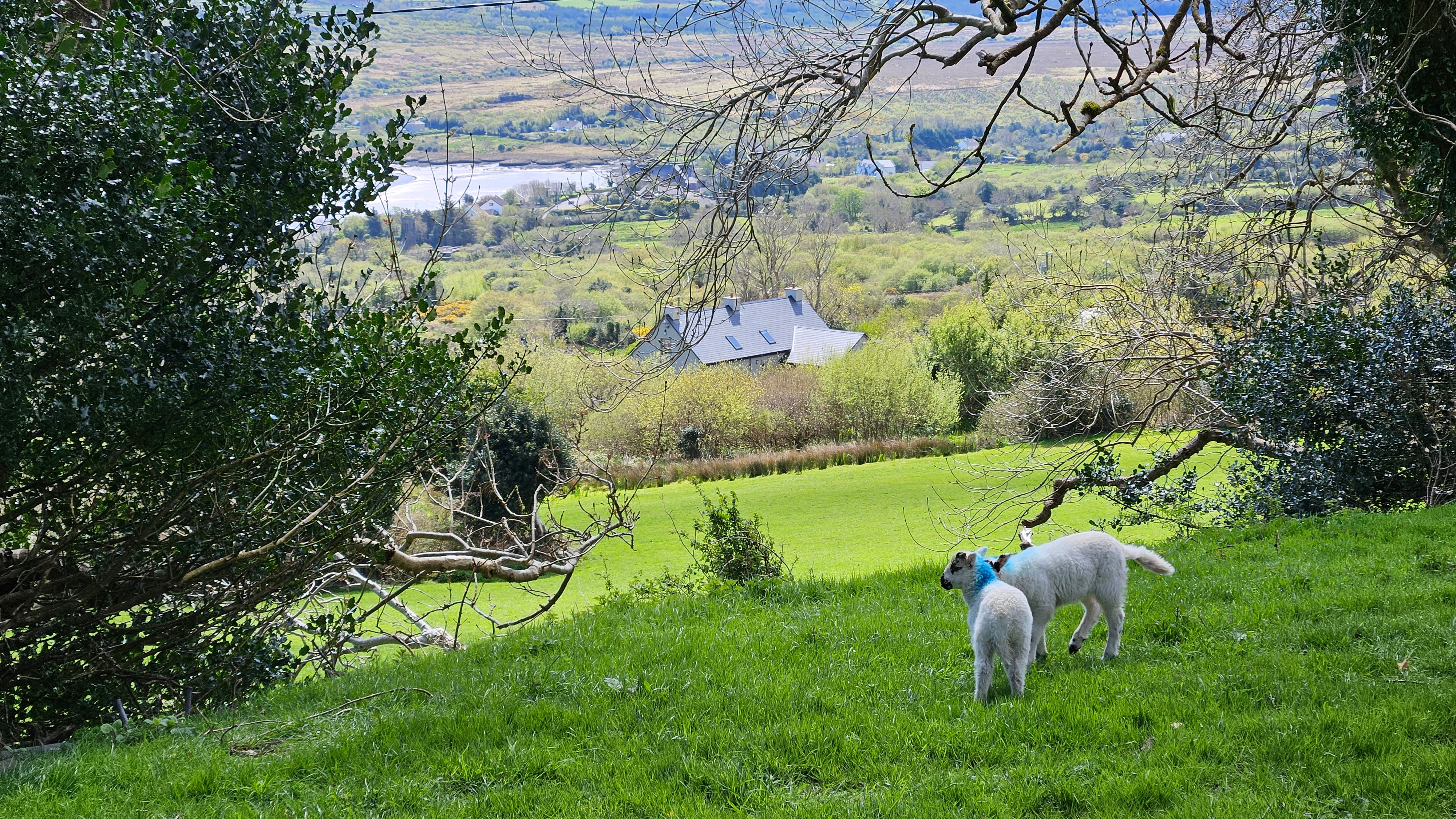
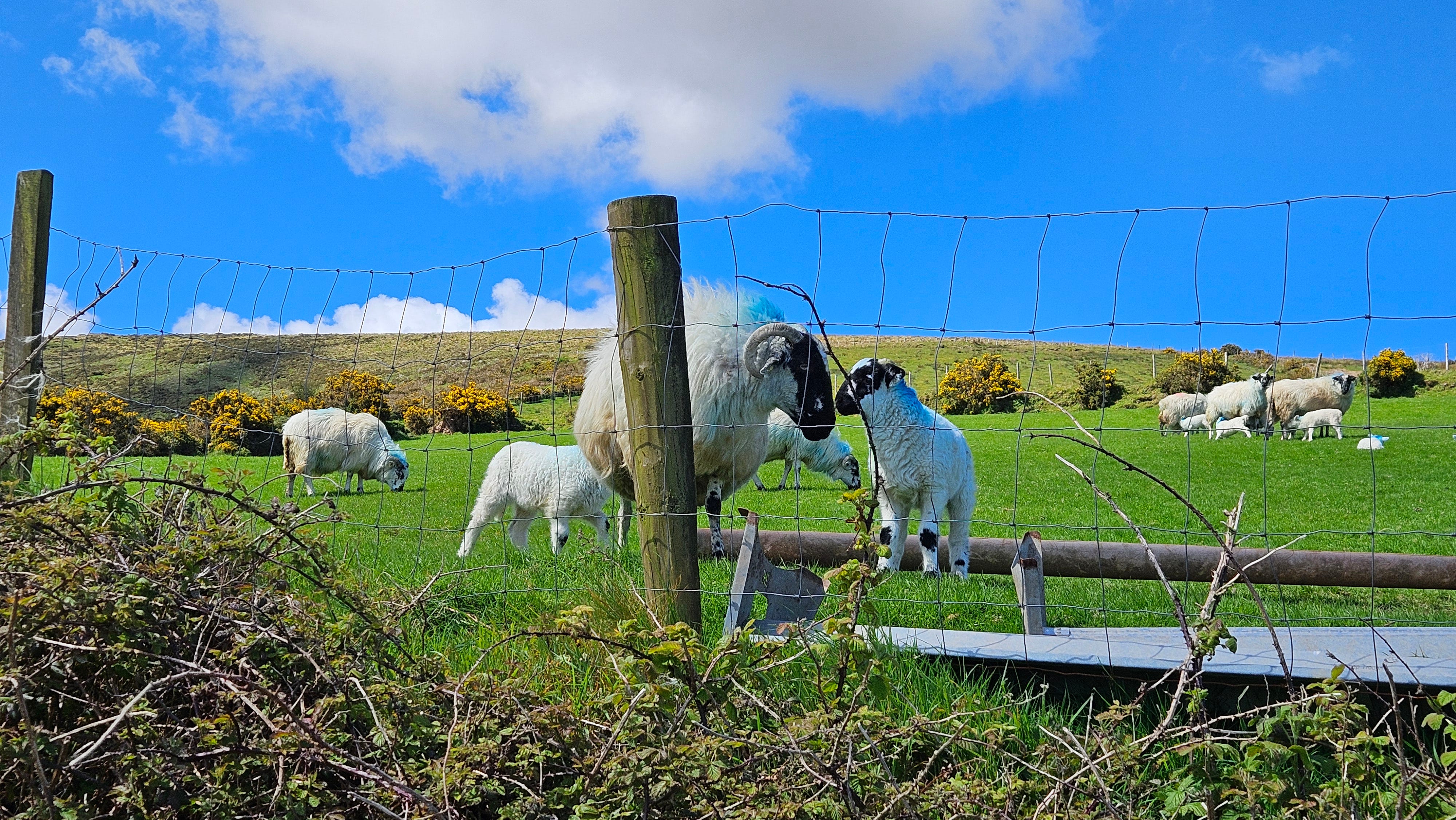
Because this is spring in Ireland, we also saw lively little lambs enjoying their new lives in green fields of every hue. (Note that the colors painted on the sheep’s backs are a kind of brand. Every farmer uses a unique color combination so that locals know exactly who each sheep belongs to.)
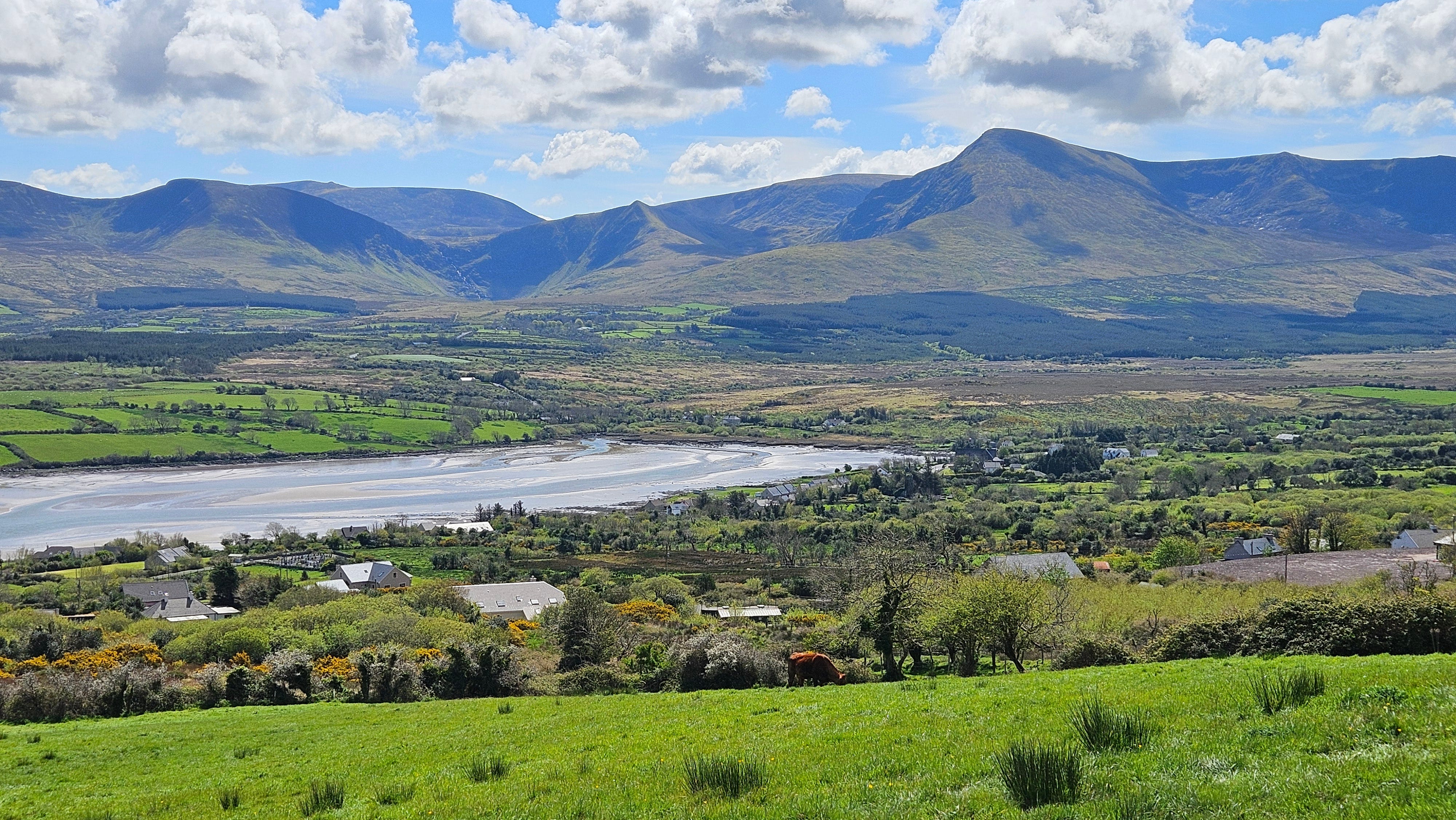
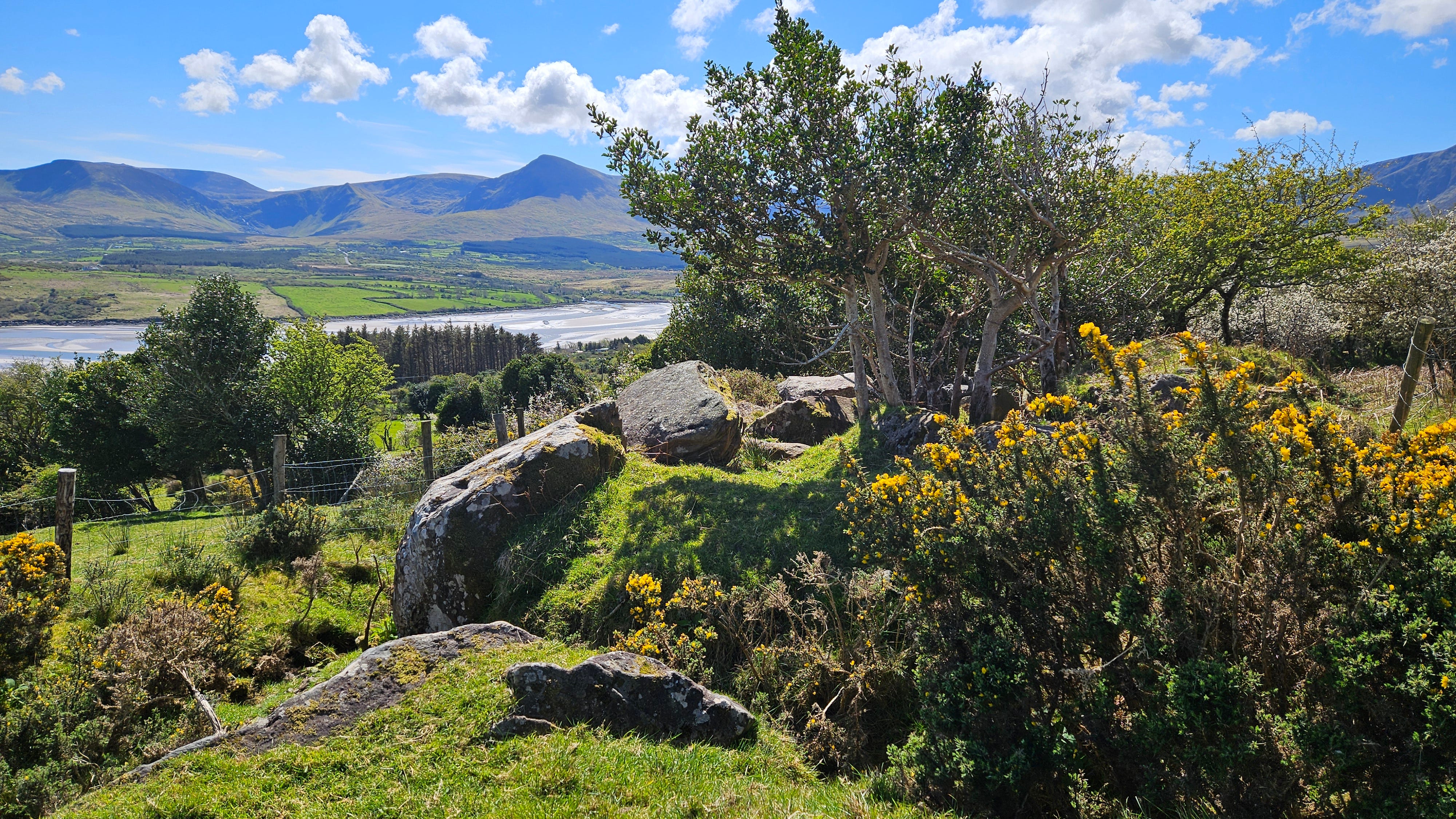
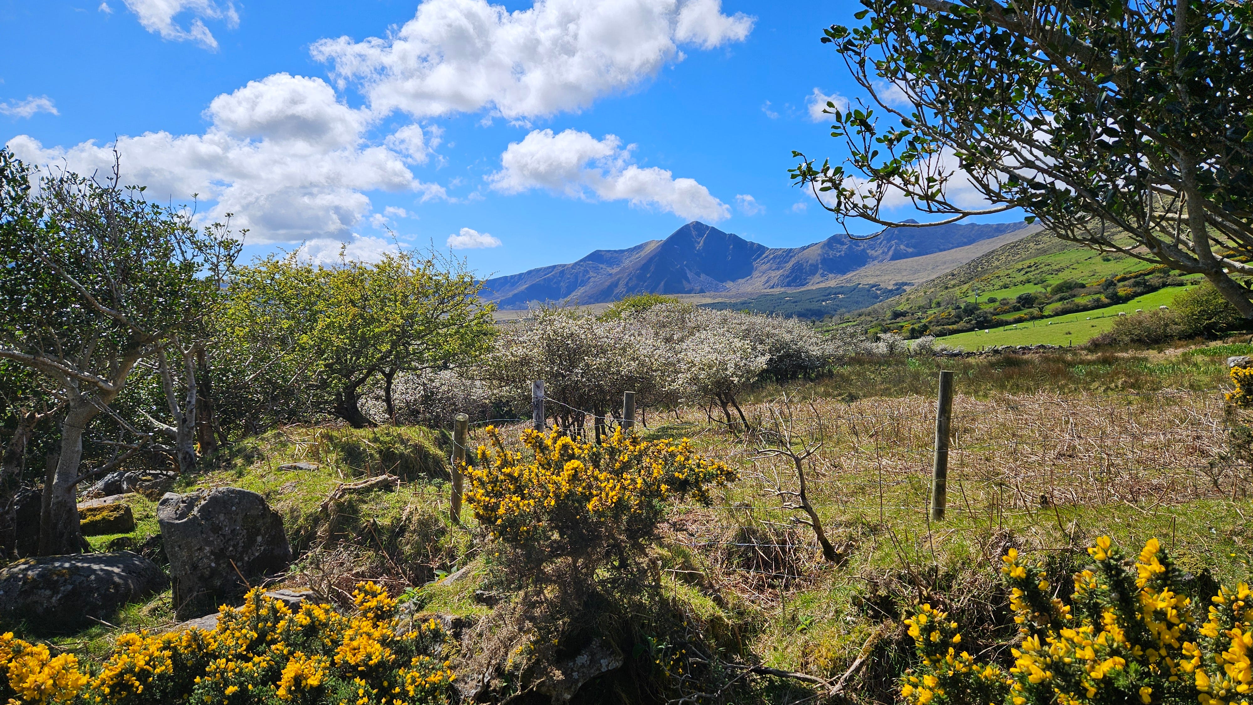
The path eventually arrives at the top of the hill and provides a beautiful view of the Brandon Mountain Range, Cloghane Estuary and Brandon Bay.
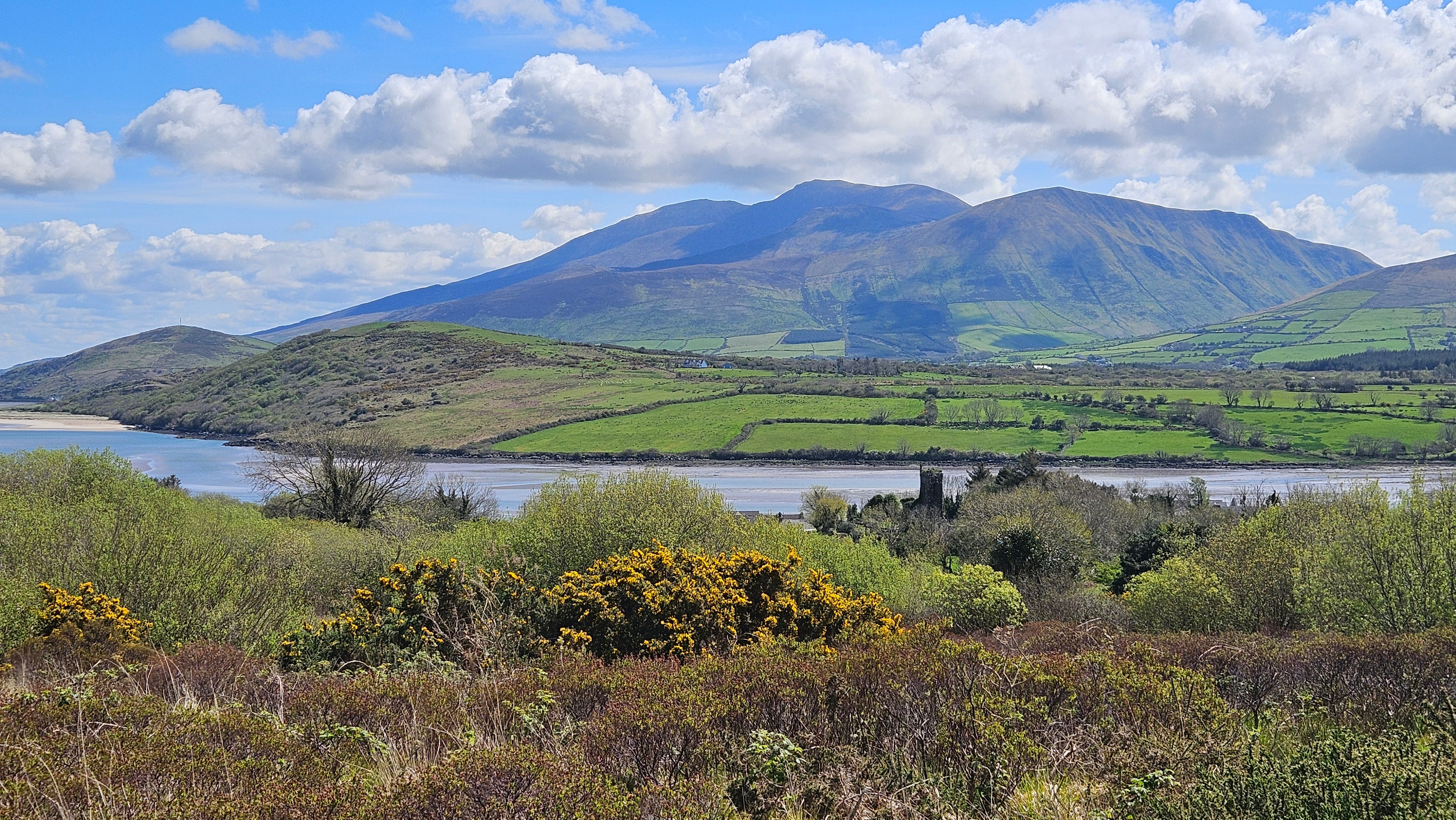
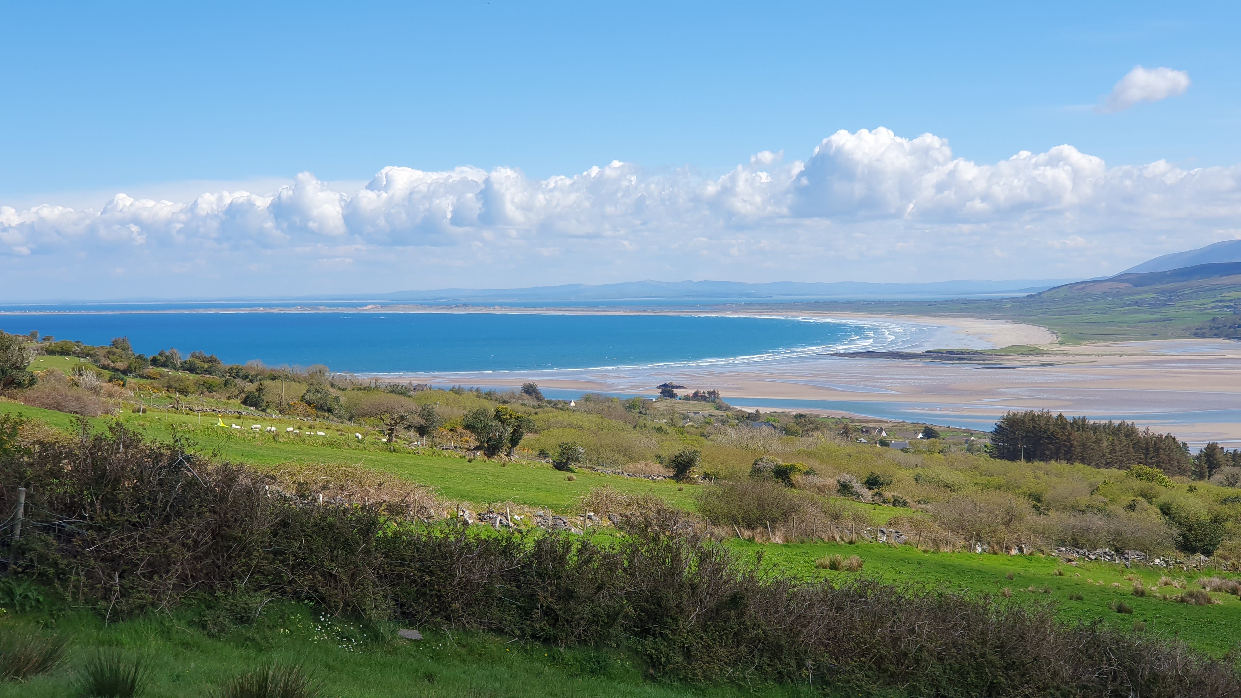
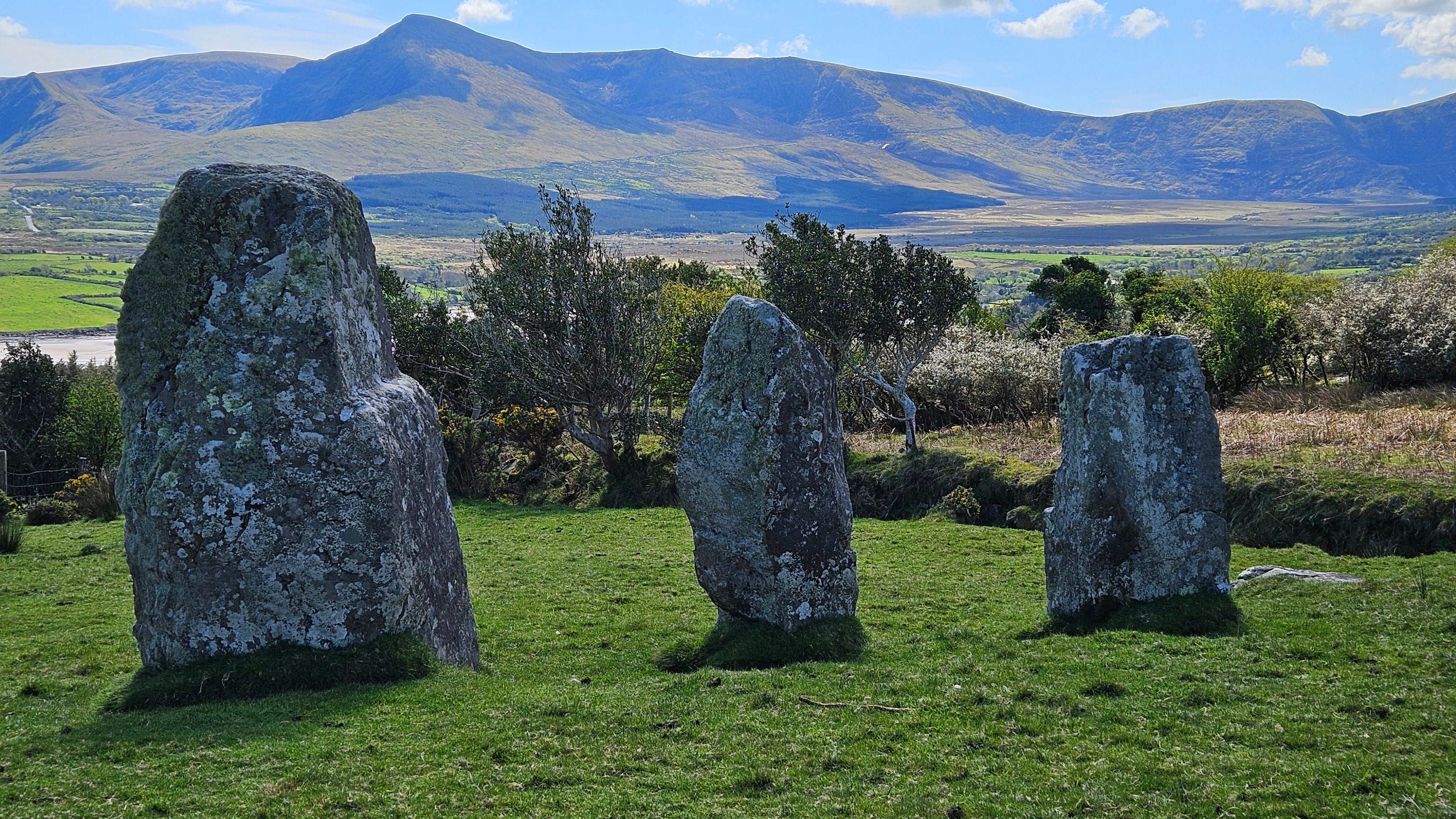
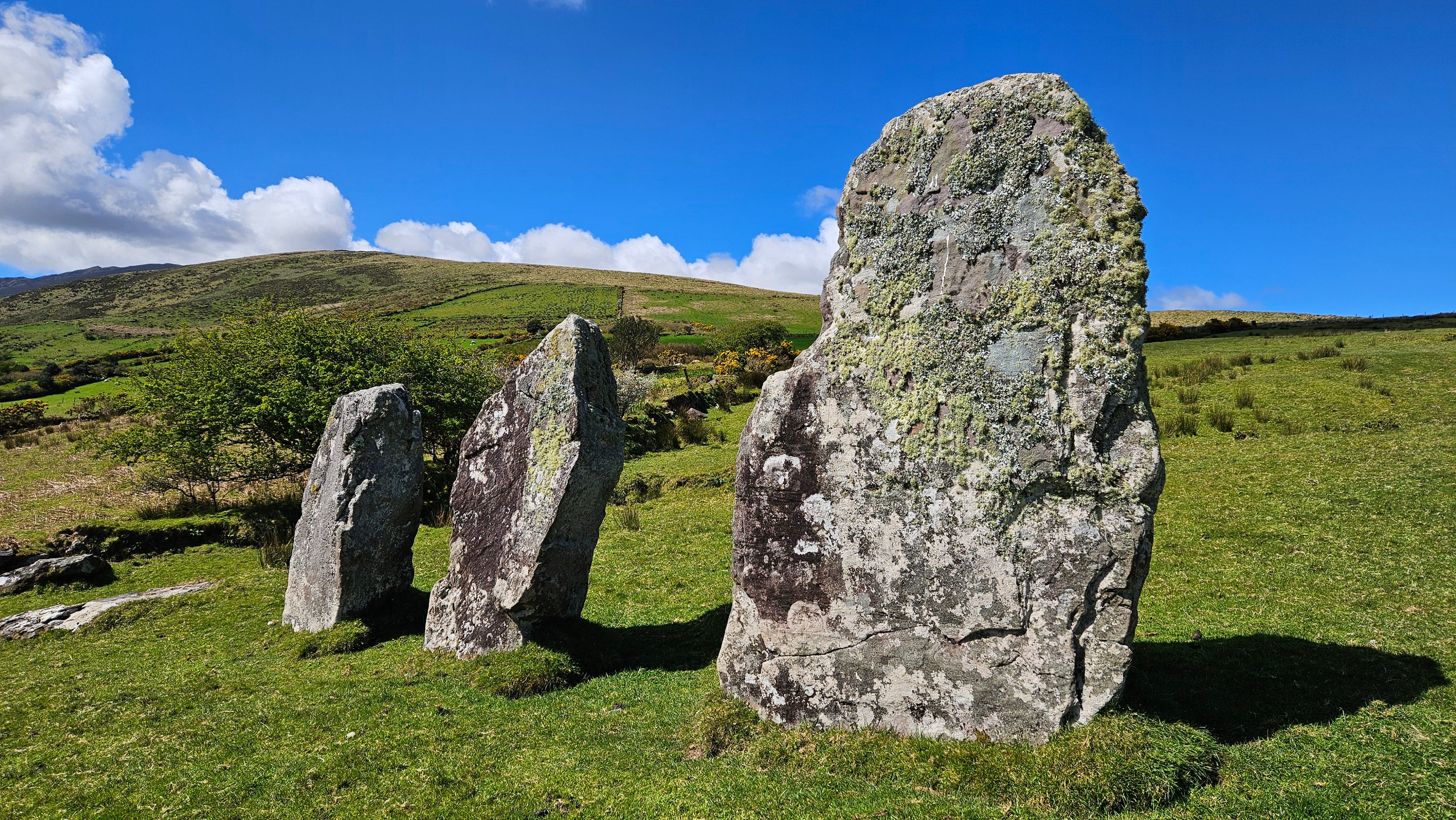
For me, the most interesting part of the walk came toward the end when Gerhard and I looked down from the top of a hill and saw the Cluain Searrach Stone Alignment overlooking the Cloghane Estuary.
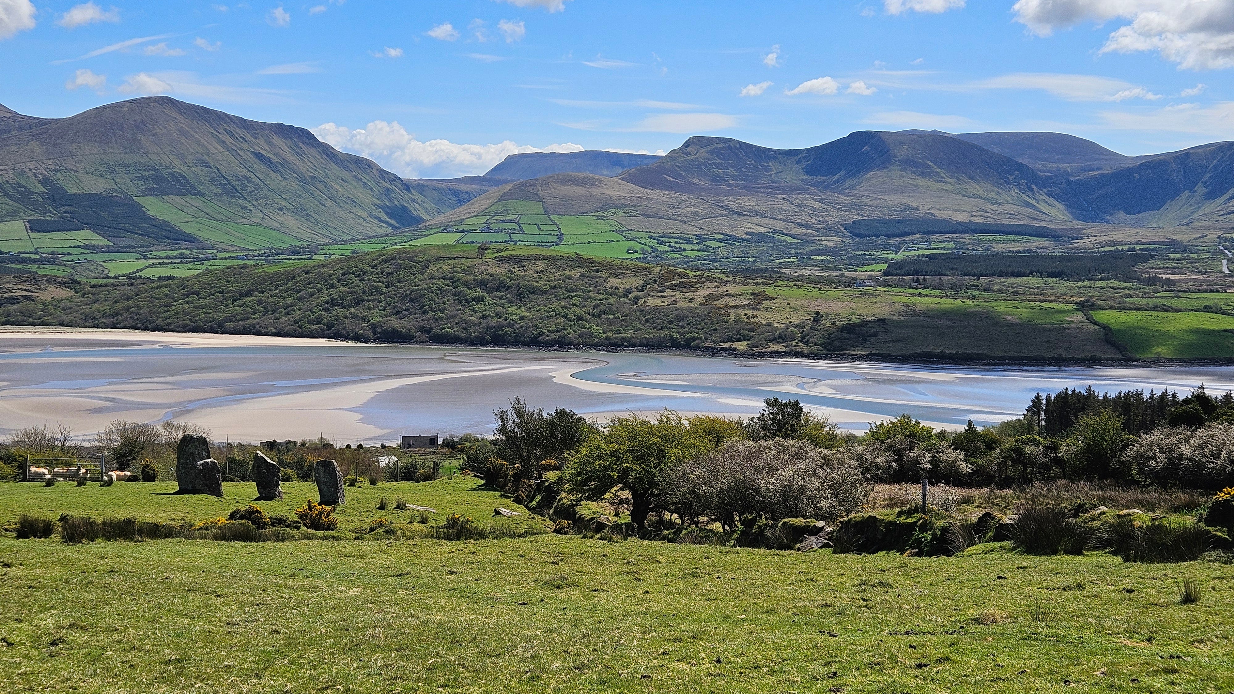
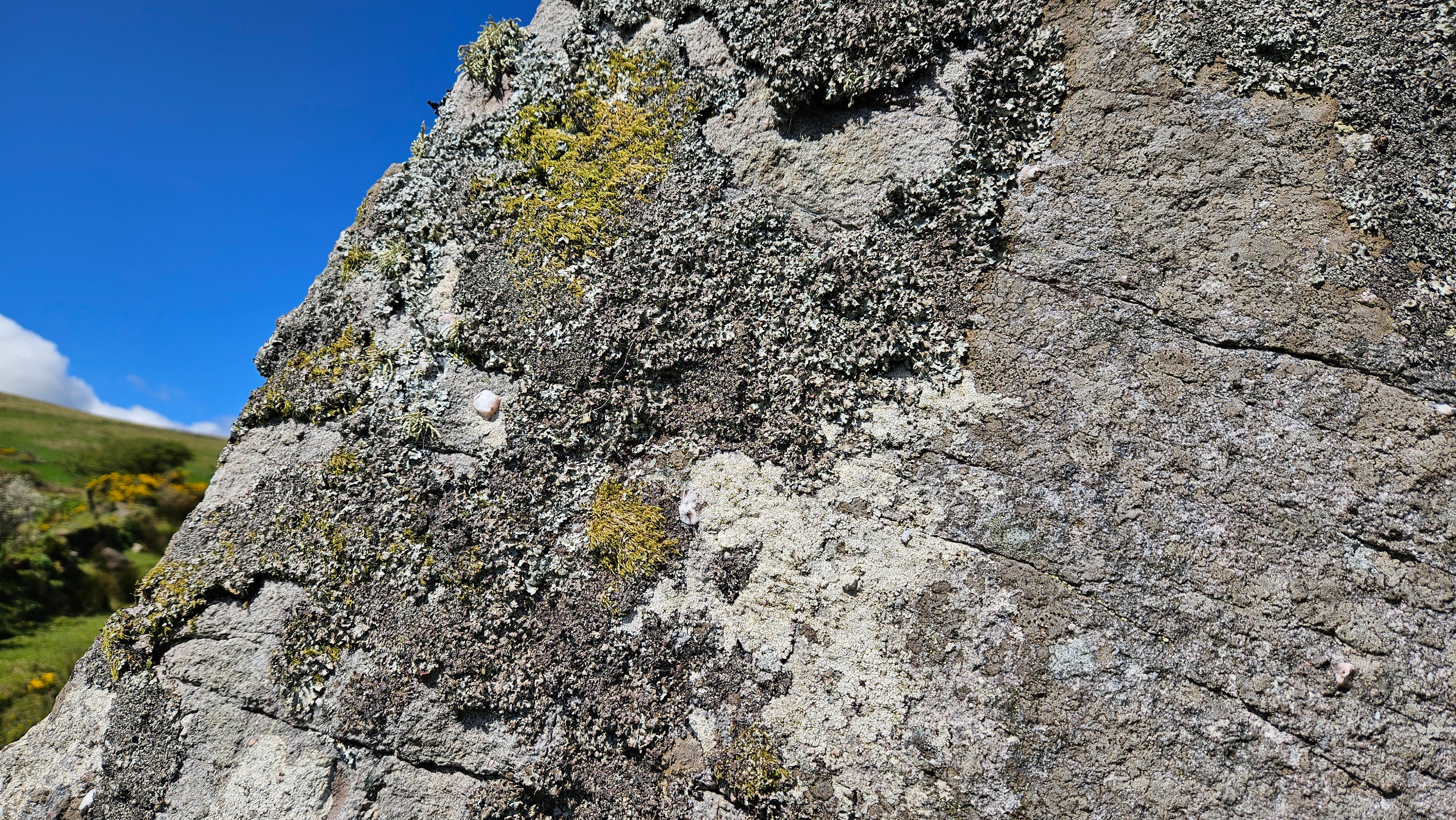
Cluain Searrach is one of only three surviving examples of a stone alignment on the Dingle Peninsula. It consists of three standing stones (Galláin) measuring 2.75m, 2.14m and 2.1m high, as well as of two stones lying on the ground that had already fallen down by the early 19th century.
The stones date from the Bronze Age and are over 4,000 years old. They are aligned in a WSW-ENE line that marks the rising sun at the summer solstice, which takes place on or around June 21st. This was an important date for ancient farming communities because it is at this point that the longest day of the year occurs and daylight gradually starts to wane again.
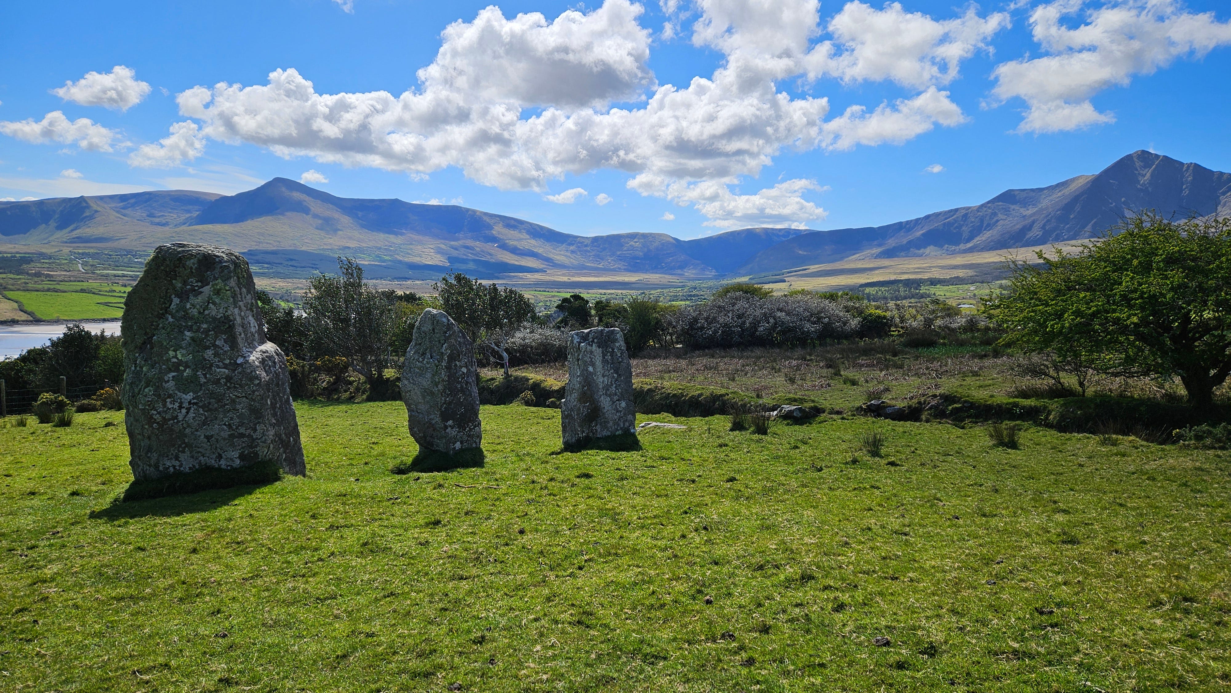

I also loved the views looking southwest from the standing stones toward an ancient orchard of flowering plum trees.
The final leg of the circular route leads again to a paved road that takes hikers back to Cloghane.
Gerhard and I thoroughly enjoyed this walk and would highly recommend it to visitors and locals alike.
Féile Lughnasa
The parishes of Cloghane and nearby Brandon host a major Lughnasa festival every year on the last weekend of July. For more information, see https://www.cflt.ie/feile-lughnasa-26-07-2018-30-07-2018/ (More up-to-date information will be available closer to festival time.)
References
*MacDonogh, S. (2018). The Dingle Peninsula. Utter Press.
Beautiful photos. I'm flagging this for August when we will be there. Thanks for all the information.
You live in such a beautiful, magical and ancient part of the world, no wonder you love it there! How many miles is the walk?